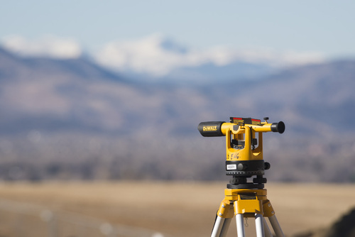
About Topographic Survey
Get an opulent topographic survey, delivered by licensed surveyors and GIS specialists, tailored to your projects requirements. Jump on board with a service where data collection combines manual expertise with advanced remote sensing, guaranteeing radiant accuracy up to 1 cm. Our survey parameters are entirely customizablepersonalise every aspect for perfect results, whether for land mapping, infrastructure planning, or environmental studies. Strict safety compliance and multi-stage data verification assure top quality, while your data arrives promptly via cloud, email, or USB/CD. Jump on top-tier mapping, India-wide.
Topographic Survey: Versatile Applications and Distinctive Features
Topographic surveys serve a spectrum of applicationsideal for construction planning, land development, environmental monitoring, and infrastructure projects. Advanced equipment such as GPS, drones, and total stations enable radiant detail, while outputs include spot elevations, boundary markings, and comprehensive contour mapping. Use types range from land acquisition to governmental approvals. With scalable survey output formats (1:500, 1:1000, 1:2000), our service perfectly adapts to client needs, ensuring precise and actionable site information for a variety of fields.
Topographic Survey: Payment Terms and Delivery Overview
Our topographic survey solutions attract interest from both the local and export market, with clear charge structures based on project size and complexity. Payment terms are tailored per contractwith initial deposits and staged payments available. Packaging of data is secure, delivered digitally via cloud or email, or physically on USB/CD, ensuring safe handling. Delivery time depends on project area and conditionssample datasets are available upon request, offering clients insight and confidence before full-scale commissioning.
FAQs of Topographic Survey:
Q: How is the topographic survey process conducted?
A: Our process combines manual fieldwork using total station and digital level with remote sensing through GPS and drone photogrammetry. Data undergoes several verification stages to ensure accuracy before final processing in professional software.
Q: What qualifications do the personnel conducting the surveys possess?
A: All surveys are carried out by licensed surveyors and certified GIS specialists, providing expertise and adherence to industry standards and safety regulations.
Q: When can I expect to receive my topographic survey data?
A: Delivery times depend on the survey areas size and field conditions. Most standard projects are completed and delivered in a timeframe discussed at project initiation.
Q: Where is your topographic survey service available?
A: Our comprehensive topographic survey services are available across Pan India, catering to a wide variety of site locations and project scales.
Q: What are the benefits of customising survey parameters?
A: Customising parameters allows the survey to focus on your specific project requirementsresulting in data sets and maps that are directly relevant and optimised for your intended application.
Q: How can the survey data be used after delivery?
A: Clients use the surveyed data for land mapping, construction design, infrastructure layout, environmental studies, and acquiring permits. The data is delivered in GIS-compatible and CAD formats for seamless integration.


 Send Inquiry

